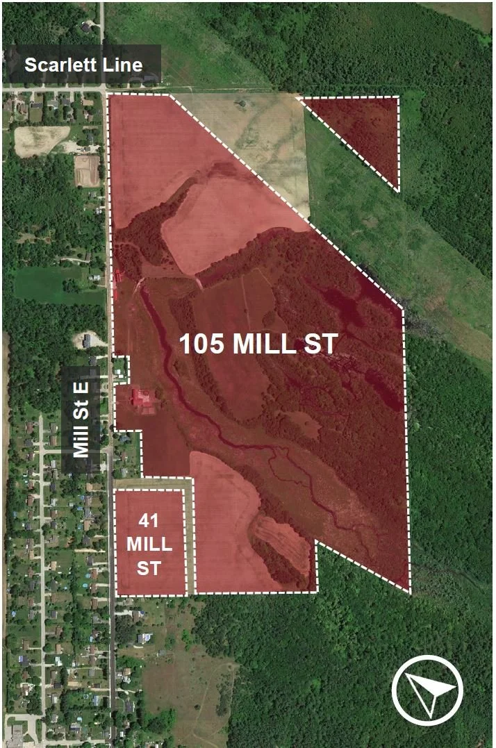
98-105 Mill St E, Springwater
Residential Development Land | 138 AC | Hillsdale Secondary Plan
Opportunity Summary
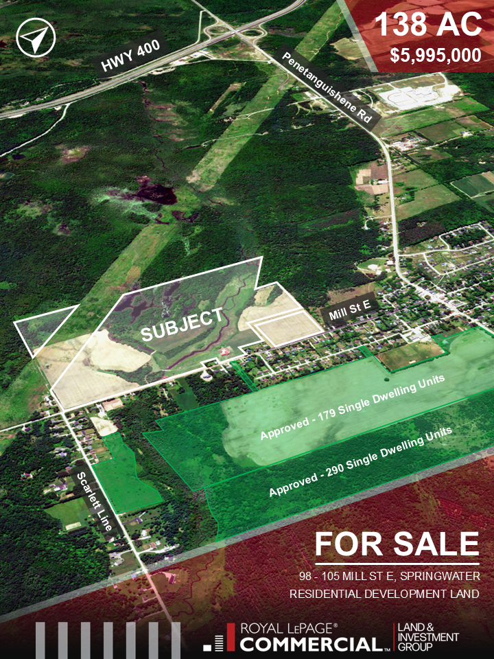
The site is composed of three parcels within the Hillsdale Secondary Plan designated as Residential Land, identified as a Major Area in Springwater's Urban Settlement Areas.
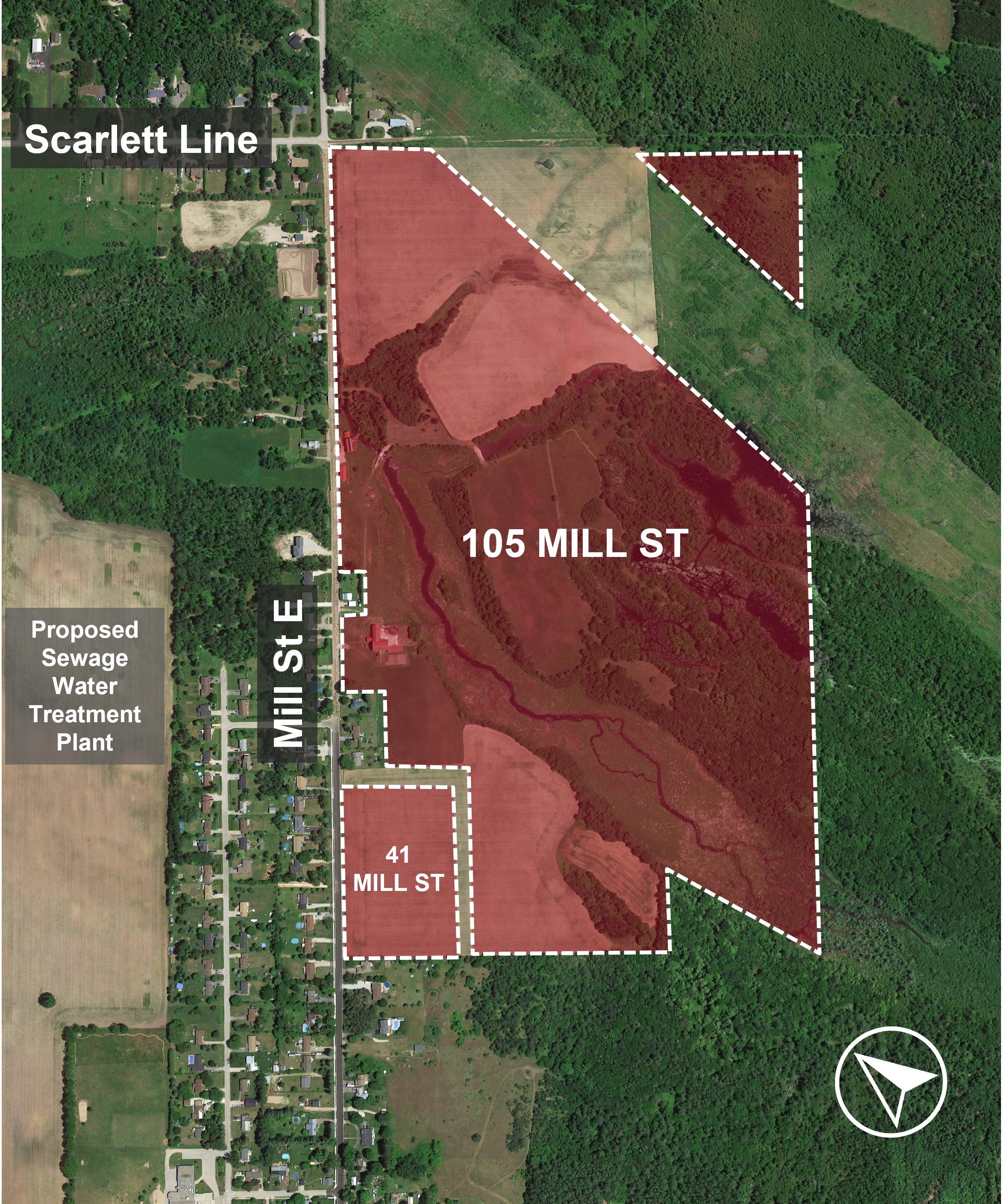
The three parcels constitute a cumulative 138.5 acres, with approximately 57 usable acres. ~70 acres of the parcel are currently being farmed.
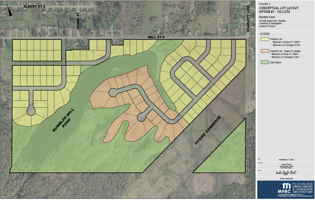
Current Secondary Plan allows 0.5 acre lot based on 100' of frontage
Potential to develop up to 132 lots under current policy
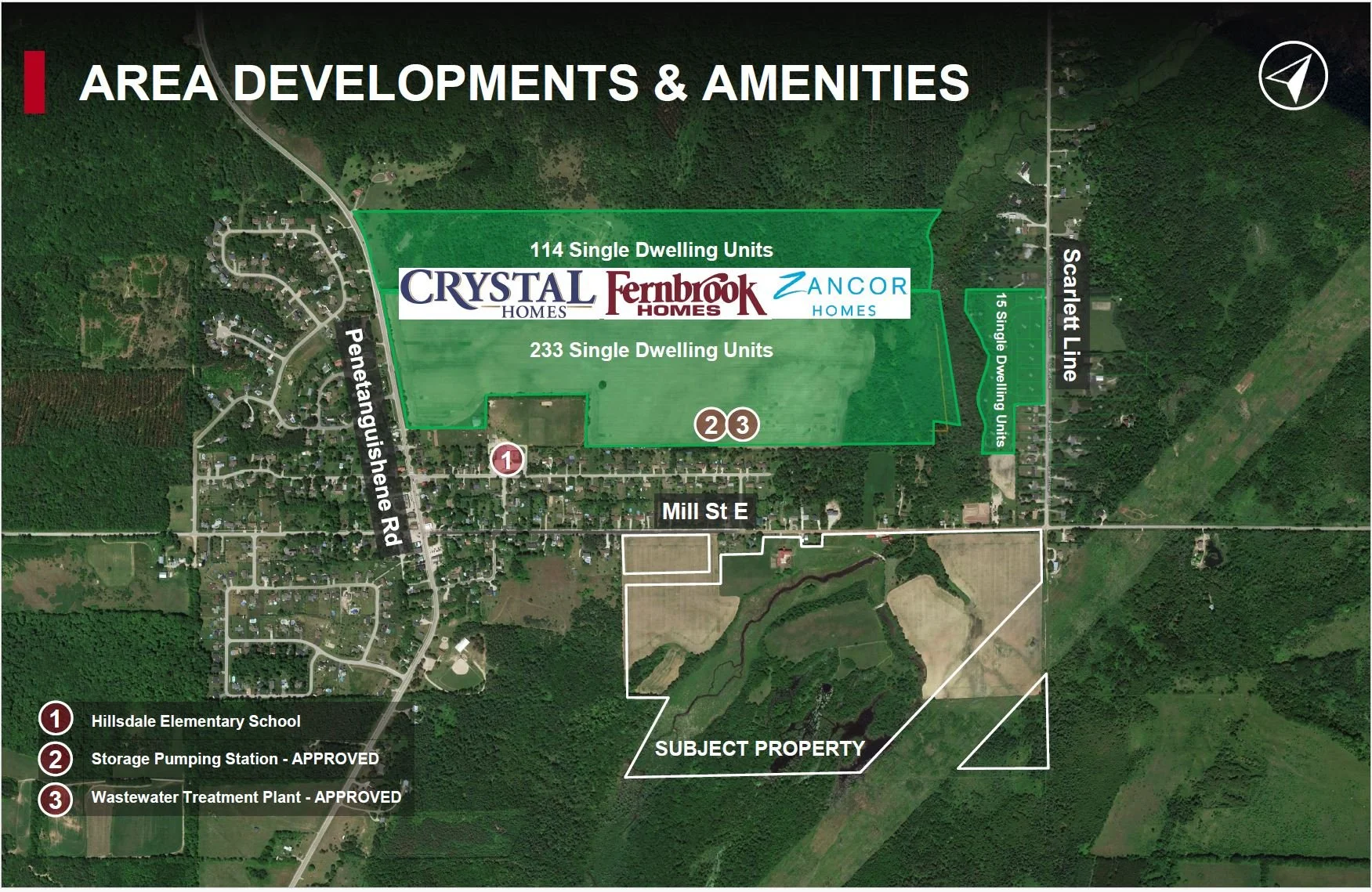
There is an approved proposal for a sewage treatment plant to be built by the landowners to the North of the site, creating an opportunity for increased density and to tap into future sewage infrastructure
Provincial forecasts note that Simcoe County’s population is expected to grow by 194,000 people by 2051, almost quadrupling in size
| Property Details | |
| Full Address |
105 Mill St E, Hillsdale, ON L0L 1V0 41 Mill St E, Hillsdale, ON L0L 1V0 |
| Lot Size |
125.3 AC 5.6 AC 7.6 AC |
| Frontage | 742 ft (41 Mill St) |
| OP Designation |
Urban Residential Environmental Protection 1 |
| Zoning |
R1 (H) - Residential A - Agricultural EP - Environmental Protection |
| Current Use |
Farm without residence, with secondary structures; with farm outbuildings |
Site Plan & Phasing
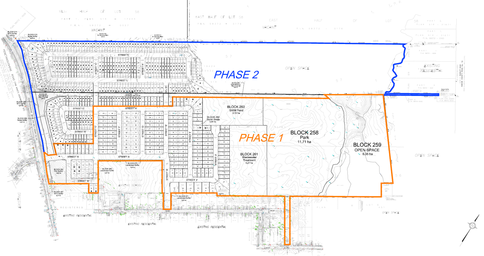
| Phase 1 | |
|---|---|
| Single Detached | 179 |
| Phase 2 | |
|---|---|
| Single Detached | 290 |
Demographics
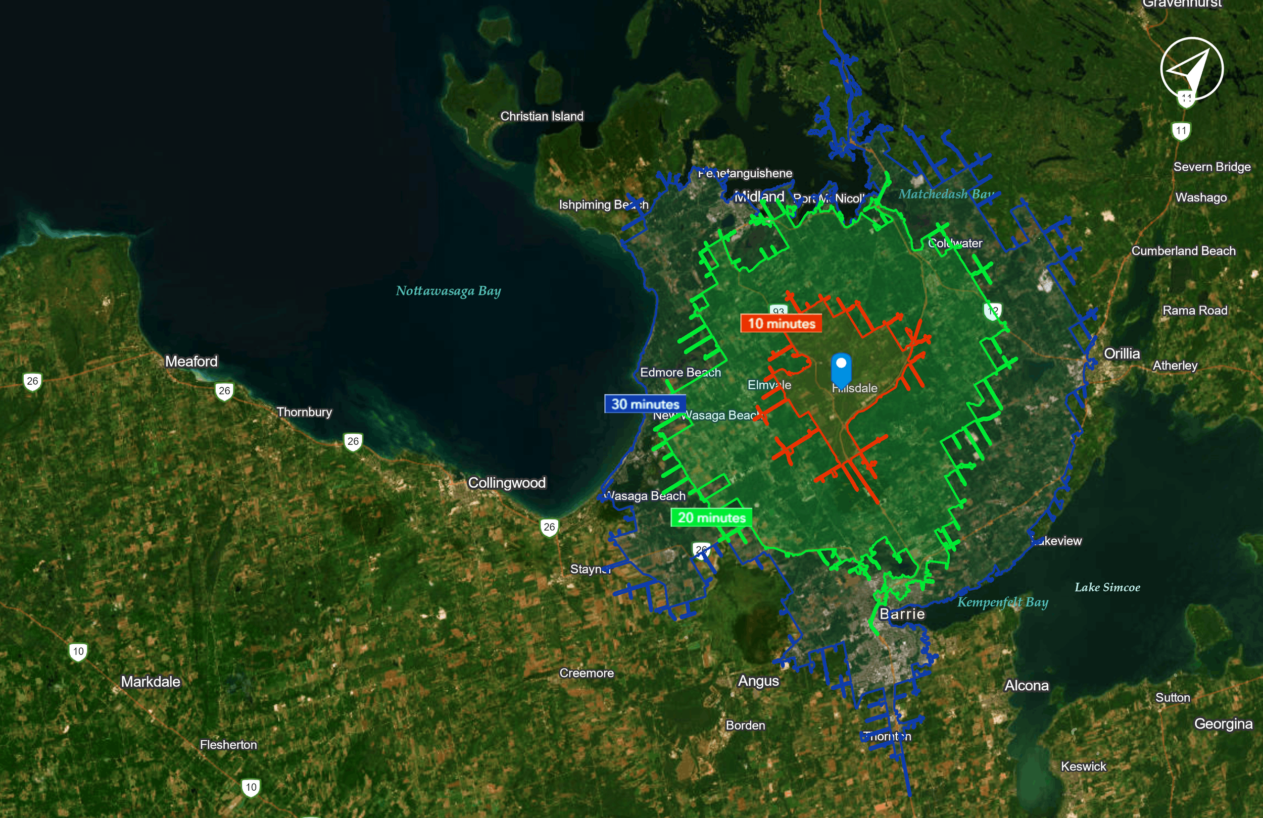
| Key Demographic Data (within 10-minute drive radius) | |
|---|---|
| Population | 5,696 |
| Median Age | 45.0 |
| Households | 1,991 |
| Median Household Income | $142,290 |
| Drive Location | Drive Distance |
|---|---|
| Horseshoe Valley | 12 minutes |
| Barrie | 22 minutes |
| Wasaga Beach | 24 minutes |
| Midland | 26 minutes |
| Orillia | 34 minutes |
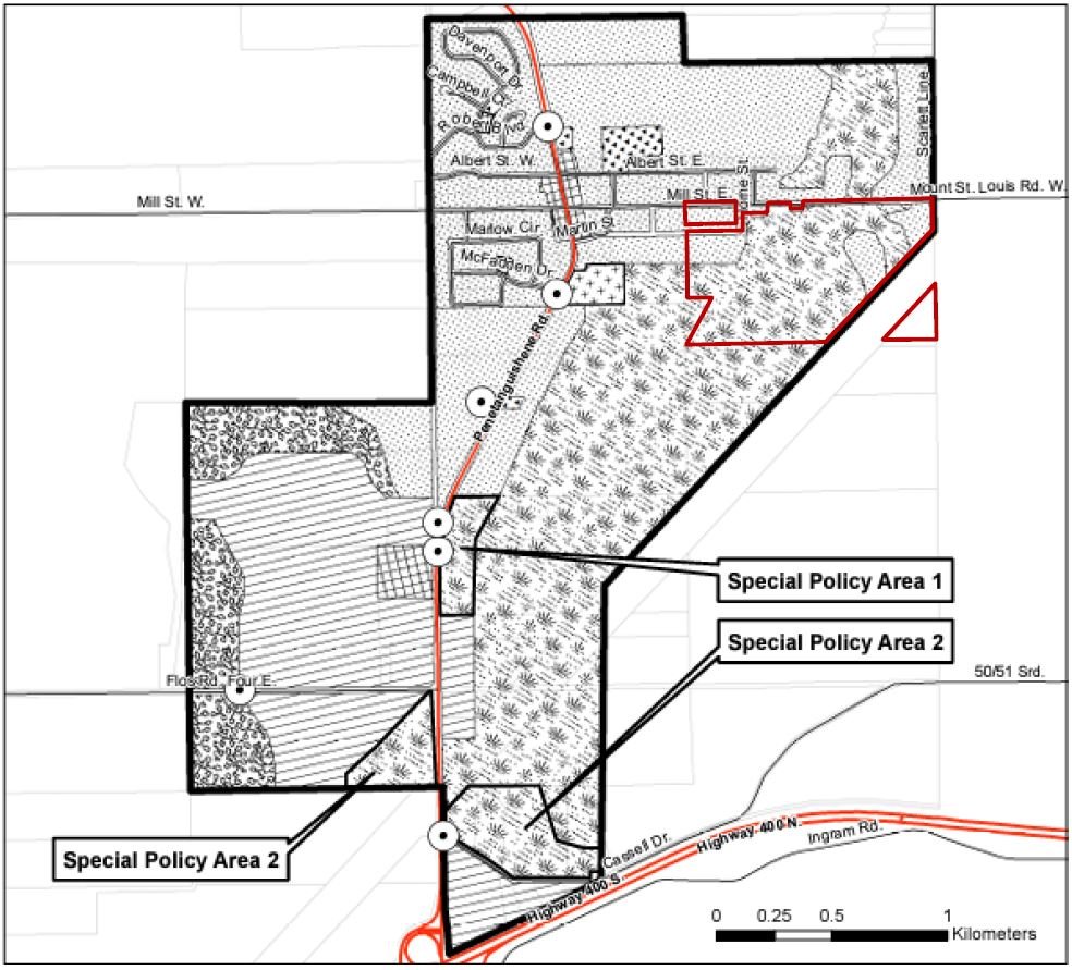
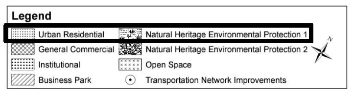
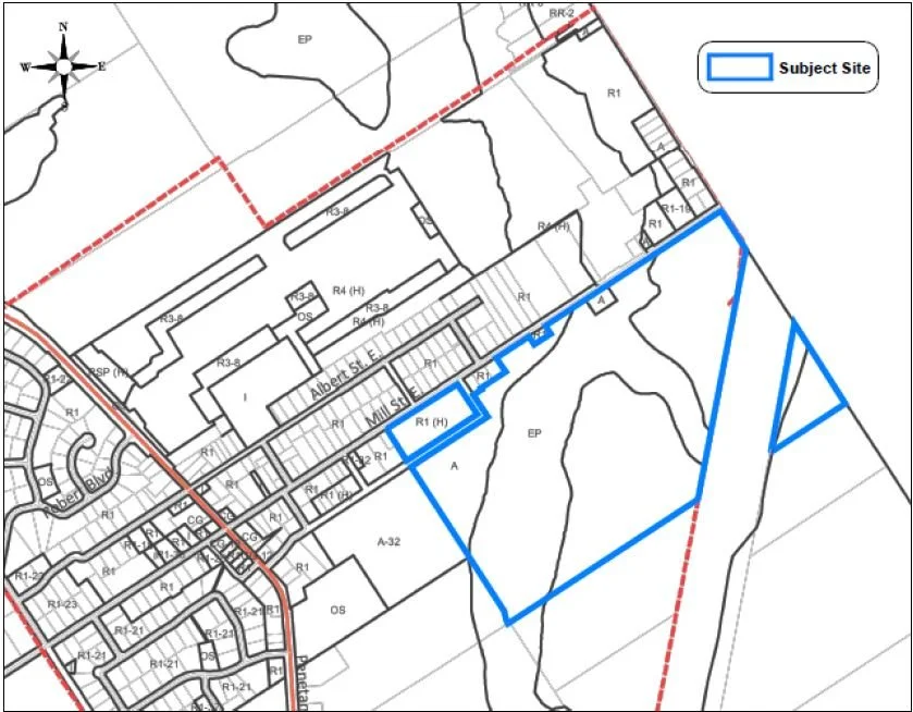
Hillsdale Secondary Plan & Zoning
Schedule A-7: Hillsdale
105 Mill St E is Zoned R1 (H), EP & A
Property is a mixture of Residential and Agricultural Zoning, with a segment zoned as Environmental Protection.
Property is part of the Hillsdale Secondary Plan. Hillsdale is categorized as a Major Area in Springwater’s Urban Settlement Areas, where they anticipate the majority of new developments will proceed over the next 20+ years.
| Elmvale | Hillsdale | Midhurst | Centre Vespra |
Snow Valley |
Anten Mills |
Minesing | Phelpston | |
|---|---|---|---|---|---|---|---|---|
| 2021 | 3036 | 1158 | 2889 | 1853 | 3555 | 531 | 738 | 258 |
| 2031 | 5584 | 2545 | 15470 | 2911 | 3804 | 909 | 738 | 258 |
| 2041 | 5678 | 4481 | 23504 | 3160 | 8952 | 909 | 738 | 258 |
Additional Information
The Designated Representatives from the Land & Investment Group Team of Royal LePage Real Estate Services Ltd. Brokerage have been retained by the vendor as the exclusive advisors to seek offers for the disposition of 41, 98-105 Mill St E in Springwater.
A data room has been created to provide prospective buyers with additional information. To obtain access, please sign and return the Confidentiality Agreement.
Offer Submission
The Property is being offered on an unpriced basis. Seller seeks best price and terms, based on the development potential. For additional information, please contact one of the listing advisors below.
All offers are requested to be submitted to Arash Fatemi or Renato Viele.
Royal LePage Real Estate Services Ltd.
4101 Yonge St, Suite 502, Toronto, ON M2P 1N6
55 St. Clair Ave W, Toronto, ON M4V 2Y7
Arash Fatemi*
VP, Capital Markets
Cell: 416.910.4726
afatemi@land-investmentgroup.ca
Renato (Ron) Viele*
Sr. VP, Land & Investment Group
Cell: 416.726.4358
rviele@land-investmentgroup.ca